I am a big fan of Then and Now photograph comparisons, whereby a photographer tries to recreate the view of an historical picture so that all the differences across time may be observed. I have dabbled with my own efforts in the past, and have been wanting to do some more for a while. The difficulty is always obtaining the interesting old photographs in the first place, however recently I stumbled across the Manchester Libraries vast photographic archive which has thousands of old images from all over the city. Interested in my new home of Ancoats and New Islington, I discovered many fascinating snapshots which showed just how much the area has changed over the decades, from working class industrial heartland to upmarket apartment living.
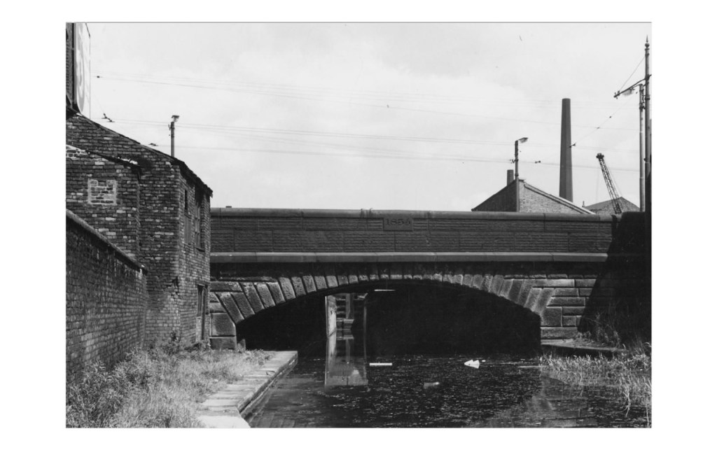
Concentrating on the canals, I decided to take a few of these old photos, and find the current views to the best of my abilities. My journey started on the Ashton Canal, just to the south of Great Ancoats Street. The original photo from 1960 shows the road bridge, dated 1835, over the canal, with the chimney of Vulcan Works mill in the distance.
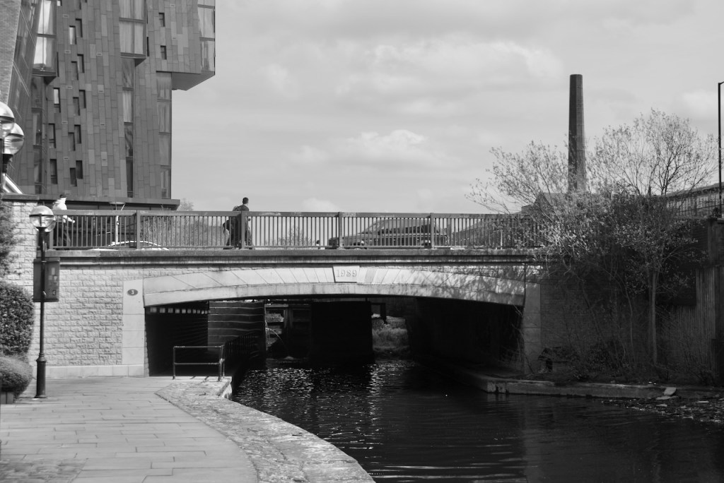
The current day view shows a new bridge, built in 1989, but the chimney of the Vulcan Works is still very much present. Joining it is the eccentric Islington Wharf apartment building.
The next scene is just from the other side of this road bridge, also taken in 1960. Run down Victorian housing edges both sides of Great Ancoat Street
Today all the decrepit old housing is gone, replaced by the 1980s Piccadilly Village development, the huge Oxygen Building, and Islington Wharf.
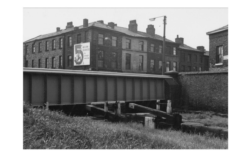
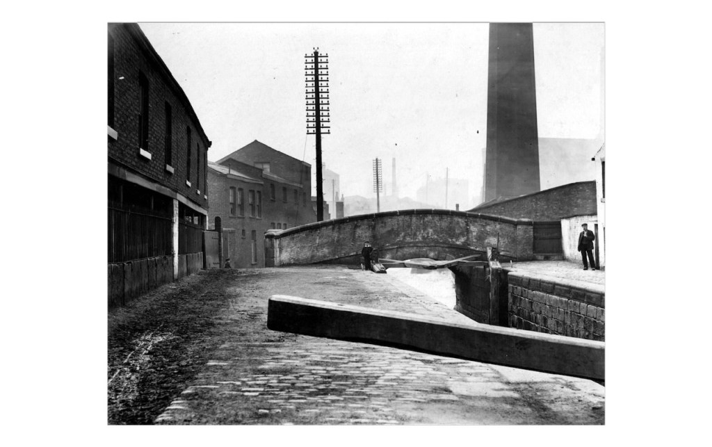
We stay in 1960 for this next photograph taken slightly further up the Ashton Canal, at Lock 3. The back of Ancoats Hospital, which closed in 1989, is visible on the left side of the picture and Victoria Mills cardboard box factory on the right.
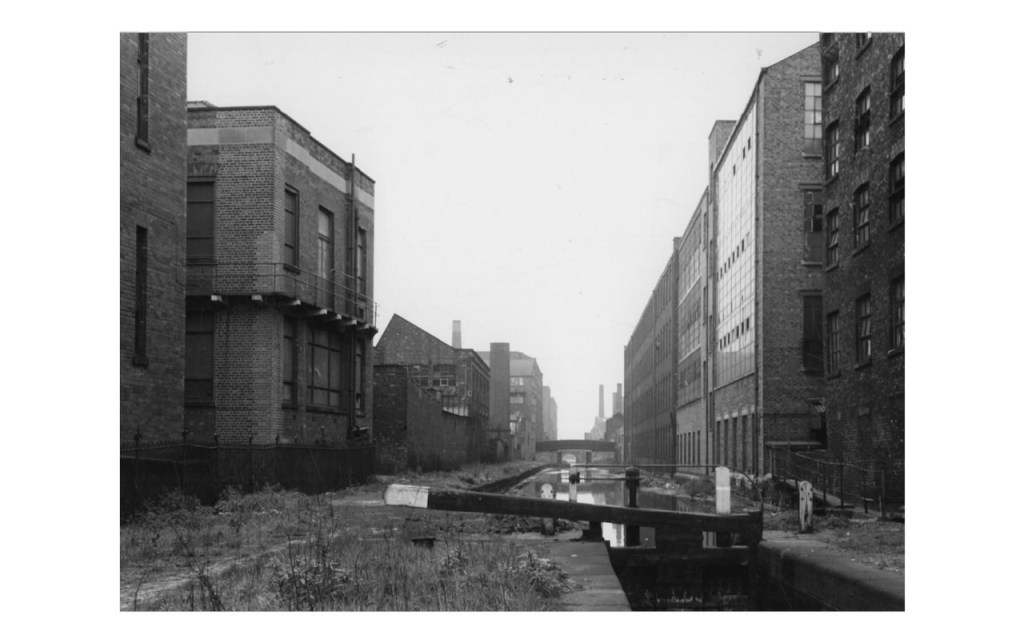
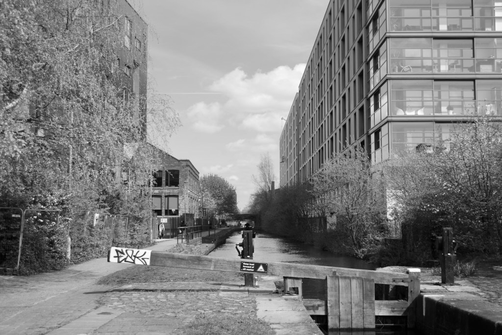
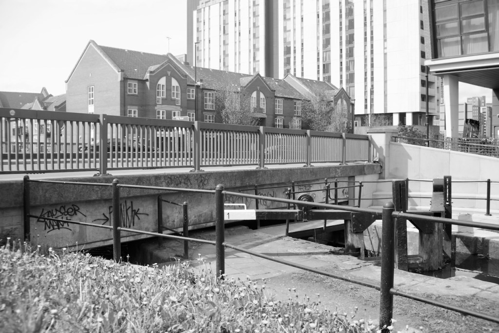
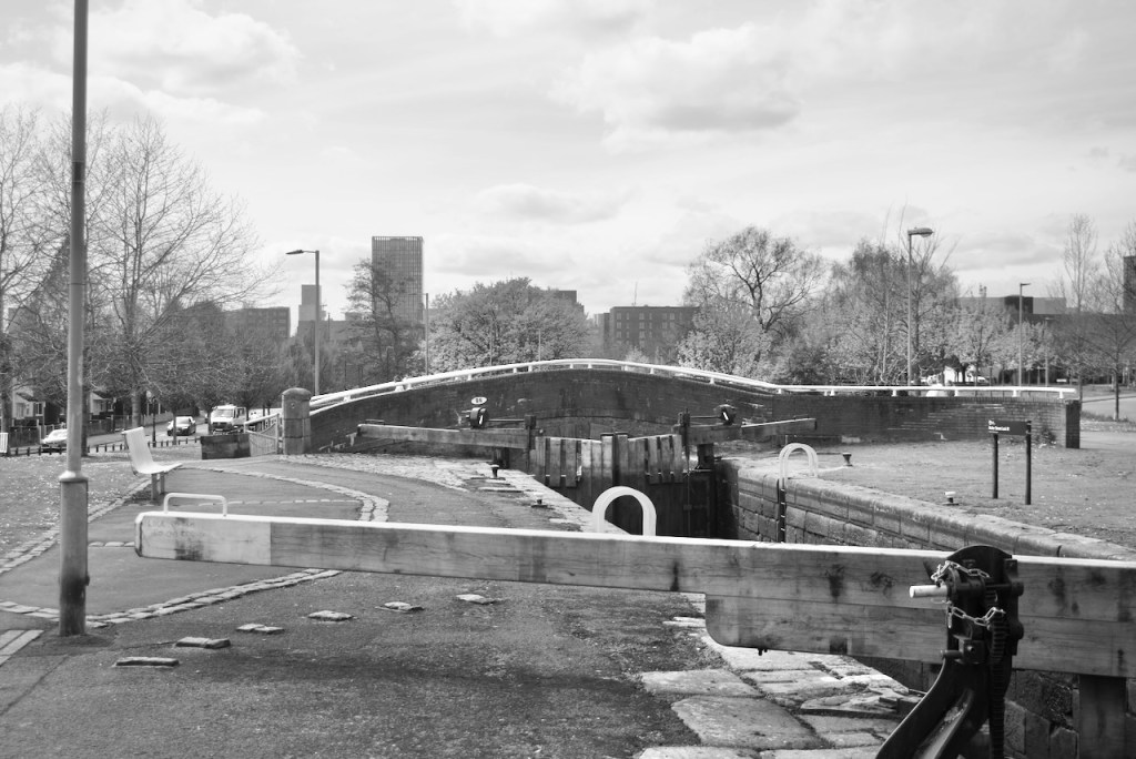
This comparison really shows the transformation of the area as both hospital and mill are replaced with large apartment buildings, including Chips on the left which was one of the early landmark buildings that led the 21st century redevelopment of Ancoats. Apart from the canal itself, the Stubbs building is one of the few common frames of reference on both images.
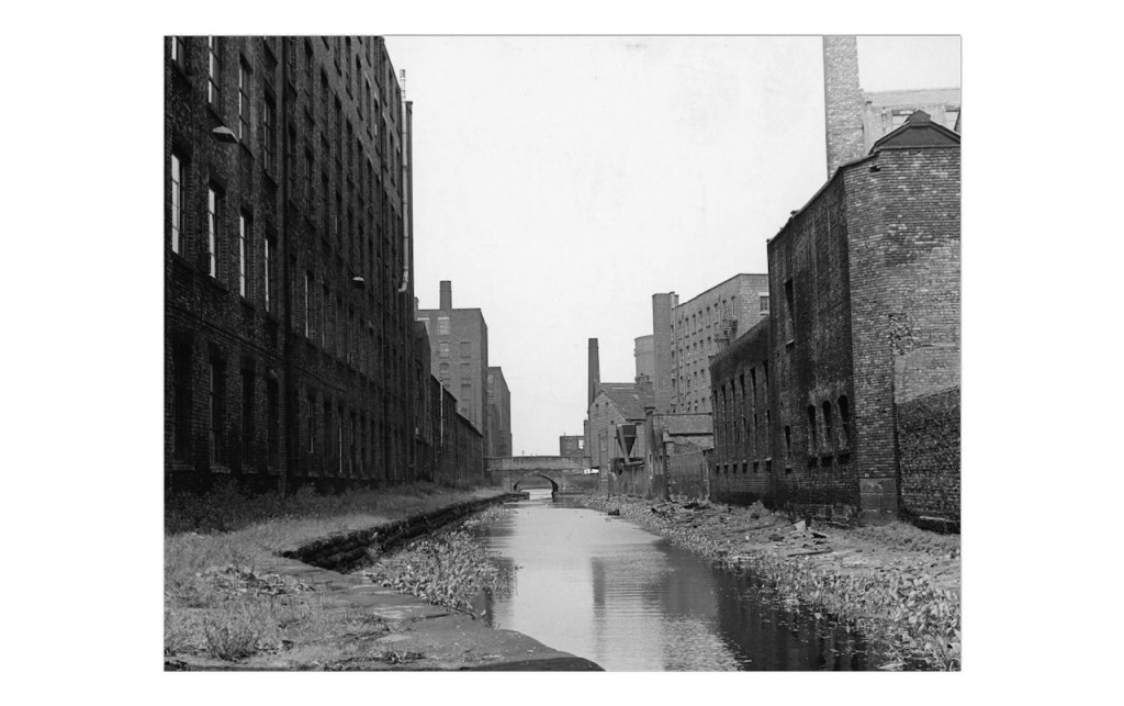
Slightly further up the canal again, we are in 1962. Mills and chimneys tower over both side of the waterway.
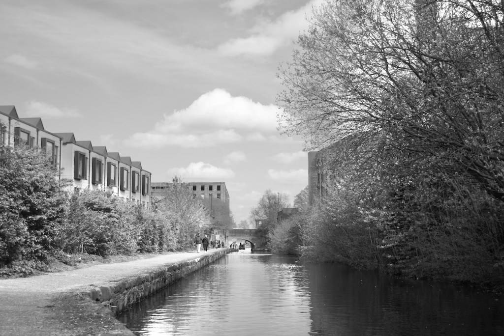
In the scene from now, the industrial buildings on the left have been swept away and replaced by Urban Splash’s modular housing system. Rather hidden on the right, Hope Mill has survived the 64 years and lives on as a performance venue.
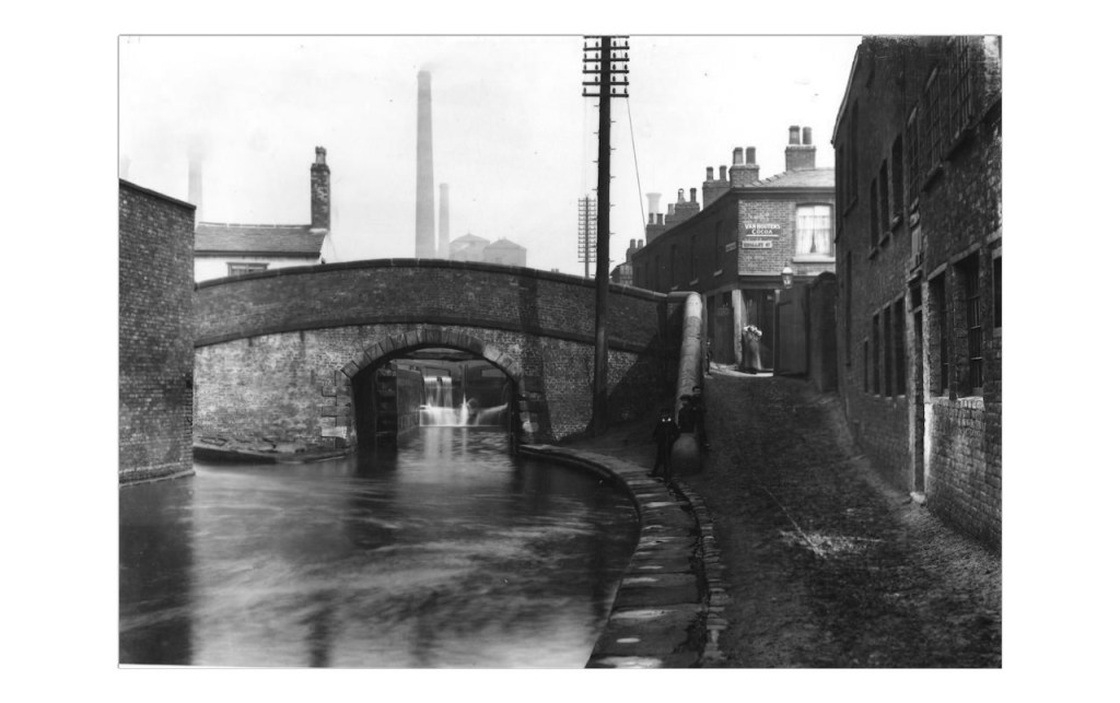
From here I crossed Miles Platting and made my way to Lock 81 on the Rochdale Canal. The original photograph is much further back in time, from 1908, taken from the lock level and facing south west, with Royle Bridge visible.
The homes, buildings, chimneys and telegraph poles in the old photo are but a distant memory in 2026.
Also from 1908 is this image of Royle Bridge from the other side. The water in the canal is blurred suggesting a long exposure time. Multiple mill chimneys rise in the distance, and housing crowds against the edge of the tow path.
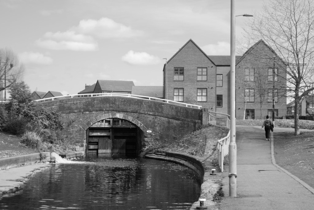
The claustrophobic industrial feel is replaced with wide open green spaces and a brand new housing scheme in the current day. In the Post-War era the canal here fell into disuse and was abandoned. In the 1970s this part was filled in and turned into a shallow linear water park as an early attempt at regeneration, but after much campaigning and effort the canal was restored to full navigation in the early 2000s. The concrete ledge in the canal on the left here is a remnant of the water park.
Turning back towards town, the next photo from 1903 shows workers next to the vast mills on Union Street resurfacing the road.

It is entirely possible that some of those stone setts from 1903 are still there on the road in 2026. The mills lining the street still stand too, obviously converted to residential use. The saw mill to the right is long gone, and the canal junction beyond it is an entirely different one from the one we know today that leads to New Islington Marina, as that was only constructed in the 2000s.
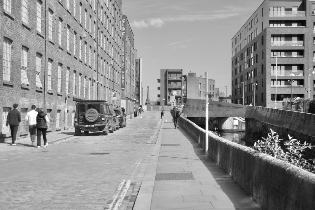
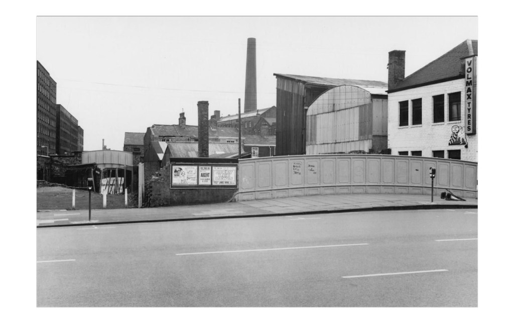
1972 now on Great Ancoats Street, facing over the road and towards the mills as seen above. A hotch-potch collection of industrial buildings lines the canal on the right.
The factories are gone, replaced by the Central Retail Park, which is also now a memory, awaiting redevelopment as a civil service “digital campus”. Standing proudly in the distance are the apartment blocks surrounding New Islington Marina.
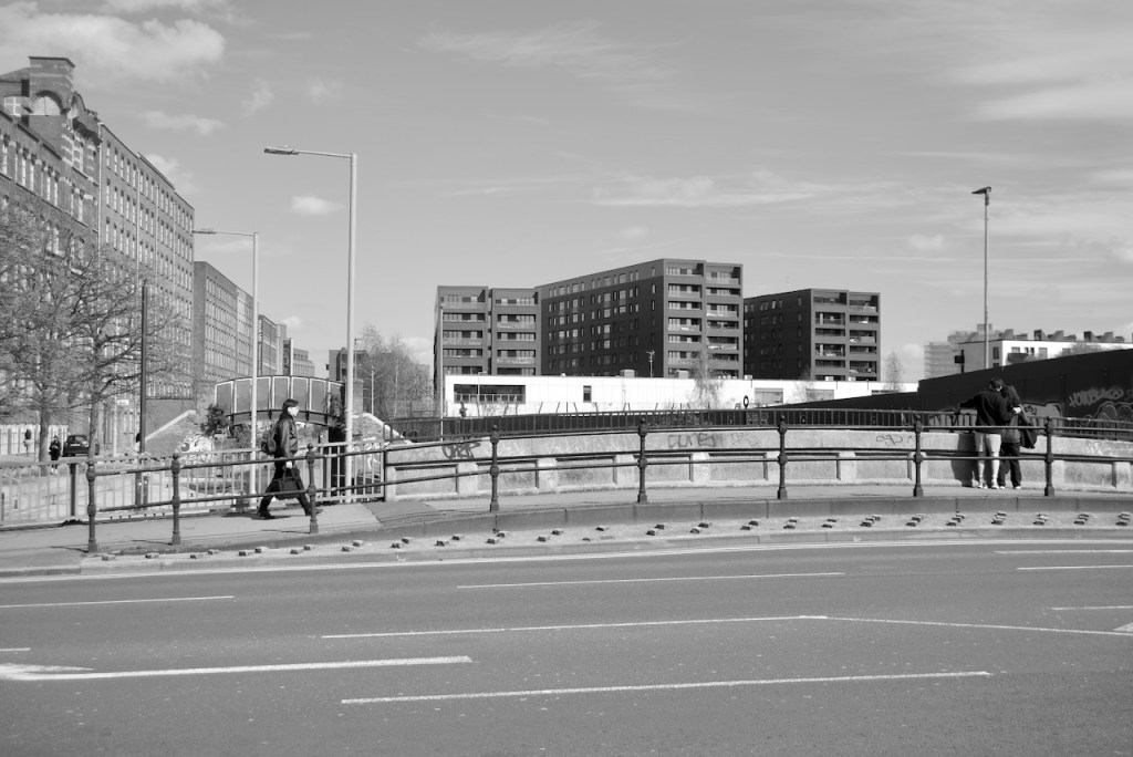
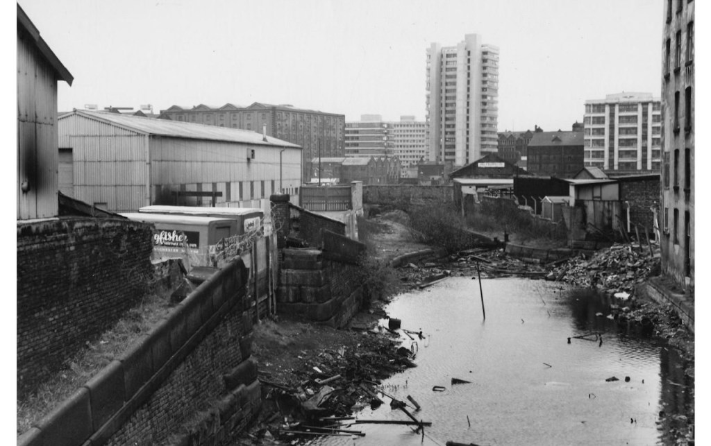
Still in 1972 we’re looking the other way from the bridge at Great Ancoats Street, over the canal towards Piccadilly. Once again we find a scene of general urban decay, with the canal now abandoned and full of rubbish, and even the tow path footbridge missing.
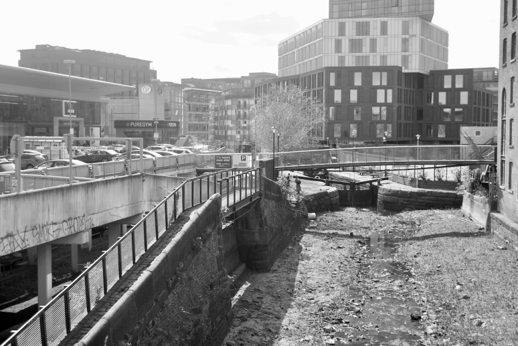
Both Ducie Street Warehouse, and the 111 Piccadilly tower, visible in the first photo, still exist but are impossible to see with all the modern developments. The Ancoats Urban Exchange retail park replaces the scruffy industrial units to the left. Unfortunately repair works on the Rochdale Canal meant this pound was empty on the day I took the photograph.
That concludes this particular Now and Then post, but given the vast number of fascinating subjects in the Manchester Libraries archive, I am hoping to make this the first in a series.
